Klingervattskogen
Klingervattskogen is located in Jämtland and is one of our most recently acquired forests. It is located in a mountainous forest area and has a shore facing Lake Klingervattnet. You are warmly welcome to support this fine old-growth forest with high natural values.
The property – (click here to show/hide)
Naturarvet purchased as a Christmas present for all donors Klingervattskogen at Åkersjön in Krokom municipality, Jämtland, just before Christmas 2024 and gained access in the spring of 2025.
The 117 ha property is located at approximately 650 m above sea level in the extensive mountain forest belt that follows the Scandinavian mountain range. The forest has a shoreline towards Lake Klingervattnet in the south and centrally houses the remains of the Klingervattbodarna mountain hut, which is still used by several of the former co-owners as a leisure area with small holiday cottages on the old property.
We are humbly grateful that this property was for sale and that we have received several large gifts that made it possible to acquire the property.
Nature (click to show/hide)
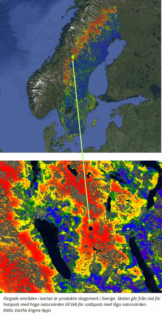
Klingervattskogen consists of approximately 79% spruce and 21% deciduous forest. The area is classified as mountain forest and consists mostly of old stands with an average age of around 160 years. There are currently only a few species registered in the Species Portal. The area bordering the property to the northeast is well inventoried and has very high natural values, which is partly due to the fact that the forest land has been grazed for a long time. Our intention is that in the near future we will make a more thorough inventory to map which species live here in Klingervattskogen and on the pasture bank.
The cultural and historical value of the Klingervattbodarna also has an impact on species that may be unique to the special ecosystems of old pasture mounds. The pasture mounds are highly endangered, as are the traditional grazing animals of hilly land breeds such as the mountain cow. There is an interest for biodiversity in keeping the open grassland of about 4 ha open through grazing. Access to animals that can graze is unfortunately also a scarce resource in nature conservation today.
Climate (click to show/hide)
The entire property area is 117 ha. The total area of productive forest land is 72.4 ha, and of that 40.8 ha is “old” forest. The remaining 31.6 ha is made up of slightly “younger” forest. But even in that forest you can see the occasional really old spruce. Trees that, thanks to their location, create important habitats for very demanding lichens, fungi and red-listed species such as the near-threatened three-toed woodpecker. According to the forestry plan from September 2024, the forest was described as ripe for regeneration felling. By Naturarvet If you acquire the forest, the logging will never happen.
Protecting Klingervattskogen and other similar old-growth forests is the most important action we can take locally to slow climate change globally.
How to get here - (click here to show/hide)
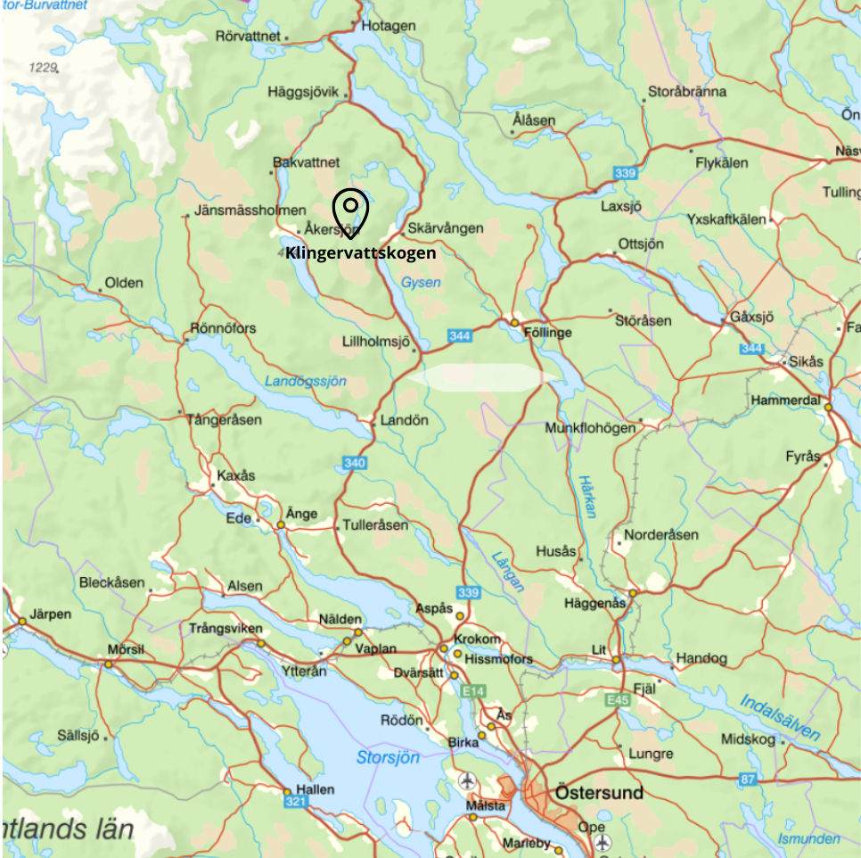
Klingervattskogen is located by Lake Åkersjön in Krokom municipality, Jämtland, at an altitude of about 650 m.a.s.l. in the extensive mountain forest belt that follows the Scandinavian mountain range. The closest villages to the east, about 7.4 km, are the villages of Stångviken and Skärvången. Two communities dating back to the late 18th century that are known for, among other things, their cheese making, flatbread baking and rock paintings on cliff walls that plunge into Lake Skärvångssjön.
The nearest community to the west is Åkersjön, which has both a ski resort, a hotel and a campsite. From Åkersjön it is 5.3 km and in the summer it is possible to get there by car along the forest road to just west of the western edge of the old forest, 63.759650, 14.168480 , where it is possible to park. There is a hiking trail from there to the pasture mound that runs along the edge of the forest north of the bogs. A snowmobile trail runs over the bogs in the winter.
From Östersund it is 93 km, and it is easy to get to Stångviken by public transport by bus, from where you can then cycle or walk the last part to Klingervattskogen.
From the east you will only find a tractor road that is used for scooters or quad bikes. As a visitor you can walk or ski up from Skärvången. Alternatively, take a car to a place that could be used as a parking space at the coordinates 63.765300, 14.227000 . When you then start your hike into Klingervattskogen, you will pass a privately owned pasture, Skalbodarna, which you should not park at or disturb.
Remember to respect the right of public access and not to disturb the privacy of residents and holidaymakers in the area. Do not park on or enter roads and land that are private. You are responsible for vehicles that may be damaged by driving on bad roads.